本帖最后由 兰卡威淑琳 于 2014-9-3 17:51 编辑
兰卡威船只免费停泊处Quick anchorage finder
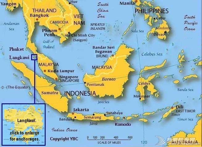
东南亚地图
兰卡威地图 Langkawi Maps
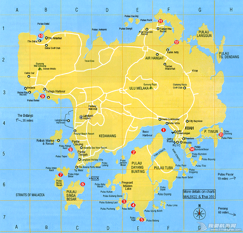
以下详情是根据上图的数字来定位 (对不起,因为我的网站是英语的。)
1。Bass Habour - Kuah
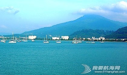
Latitude: 06.18.87'N Longitude: 99.50.89'E Average Depth: 2 to 3 metres
Best months for anchoring: December to April. Not so good: May to November.
Description:
Bass Harbour is the main anchorage for Kuah Town. At two hours either side of high tide, it is very handy for provisioning by dinghy, either directly to Teow Soon Huat supermarket in the NW corner of the bay, or to any suitable location on shore. If attempting to land dinghy at low tide, it's best to go Jetty Pelancongan, situated halfway between RLYC and Kuah Town. Landing fee is RM3 per day.
NOTE:
This anchorage is only suitable for doing your shopping then moving out to one of the much better locations listed here, particularly if you want to swim or be assured of a good night's sleep.
BEWARE:
The holding ground here is poor and your anchor will drag in SW squalls of over 20 knots that occur frequently during May-Nov.
DANGER:
A dangerous unmarked rock lies just beneath the surface at Lat: 06.15.10'N Long: 99.44.90'E (SE of P. Selang at end of Bass Harbour. See the anchorage map for the approximate position)
IT HAS CLAIMED MANY BOATS AND IS NOT ON SOME CHARTS.
2. Monkey Beach.
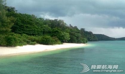
Latitude: 06.15.77'N Longitude: 99.47.72'E Average Depth: 3 to 4metres
Best months for anchoring: December to April. Not so good: May to November.
Description:
Only 5nm from Kuah Town, so makes a handy day spot to anchor before moving to either Singa Besar or the "Fjords" for a more comfortable night anchorage. Has barbecues and wood on site.
Good for lunch, but the 'mozzies' arrive at night. Many monkeys wait for scraps. Take care, there are some mean greedy ones that might bite. About 50mtr in from the beach is a nice cave with stalagmites & stalactites that goes in for 100mtrs.Take a flashlight & wear sneakers. See waterfall after easy climb from NE corner. It flows May-Dec when fresh water can be collected from a stream at southern end of beach.
NOTE:
This anchorage is fairly exposed and on a lee shore, so you might want to check weather before leaving your boat unattended.
HOLDING:
The holding ground here is good in firm mud and clay.
DANGERS:
The only danger is an unmarked rock lying just beneath the surface, situated at end of Bass Harbour, SE of Pulau Selang at Lat: 06.15.10'N Long: 99. 44.90'E See the anchorage map for the approximate position. Don't cut corner if heading SW down channel.
3. The 'Fiords'
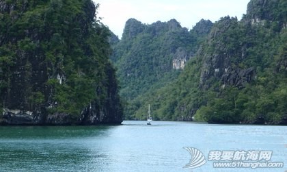
Latitude: 06.11.13'N Longitude: 99.47.23'E Average Depth: 3 to12 metres
Best months for anchoring: All year round !!! Not so good: Nil
Description:
The area known as "The Fjords" is the name given to this general group of islands SE of Kuah. For peace & quiet and best protection from any nasty weather, it is equal to the "Hole In The Wall" anchorage in the NE of the island. While anchored in the Fjords, take a dinghy trip to the "Pregnant Maiden Lake", about 1nm to the NW. Another option is to anchor your yacht there, but from 1000-1600 there are dozens of long-boats full of tourists to cope with on most days. Take your bathing suit for a refreshing fresh-water dip in the lake. But, be aware of the lake's legend of "having magical fertility powers" :-))
NOTE:
Due to the limited space, this particular anchorage is suitable for only 5 or 6 average size yachts to swing around on tide changes.
HOLDING:
The holding ground in mud, clay and shale, is excellent.
DANGERS:
There are no hidden dangers, but the occasional fishing boat might anchor a bit closer than you'd like. That's a good time to go and make friends with them, ask if they have any fish to sell and politely ask them to re-anchor. (At worst, you'll have fresh seafood).
4. Christmas Bay.
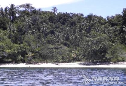
Latitude: 06.10.71'N Longitude: 99.48.15'E Average Depth: 3 to 4 metres
Best months for anchoring: November to April Not so good: May to October
Description:
A few years ago this delightful spot was selected for a yachties special Christmas Day party and has since kept the name. Although Christmas Bay is quite large, the sandy bottom tapers very slowly to the beach which means keel yachts need to anchor out at least 300 mtrs before reaching the average depth as shown above. If stopping for just a few hours, you can sometimes work the tides and sneak in closer. It's great for a swim in clear waters and to relax under the big shady trees. Not much else to do - but who cares :-)) Even in the high season with prevailing winds out of the NE, the late
afternoon sea-breeze can freshen from the SW and make the bay lumpy for a short period, then it settles down again for a quiet night.
NOTE:
Best holding and deeper waters are on the bay's east side.
HOLDING:
The holding in hard packed sand and mud is excellent.
DANGERS:
There are no dangers. Watch tides if anchoring in close.
5. Fisherman's Cove
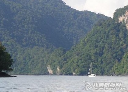
Latitude: 06.10.05'N Longitude: 99.48.80'E Average Depth: 3 to 4 metres
Best months for anchoring: All year round. Not so good: Nil
Description:
This location is very similar to "Fjords" anchorage # 3. The main difference is that it's smaller, having room for 3 - 4 yachts, which depends on how many fishing boats anchor there. Squid boat crews sleep there during the day before leaving at sundown to work. Then the day boats come in and usually raft up together for the night. To do that they prefer to anchor in the middle which leaves the edges clear. The last time I was there, I found it simple to drop anchor out from the Northern shore, then reverse until close enough to attach a stern line to a tree. That cancels any worries about swinging on tides.
NOTE:
Being surrounded bythehigh-sided islands offers maximum protection from bad weather, but it also cuts down cooling breezes.
HOLDING:
The holding ground in mud and shale is excellent.
DANGERS:
None. Watch tides, if not tied by stern line to the shore.
6. Singa Besar.
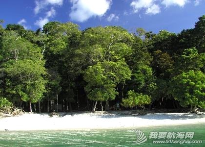
Latitude: 06.13.67N Longitude: 99.44.71'E Average Depth: 3 to 4 metres
Best months for anchoring: All year round. Not so good: Nil
Description:
The literal translation of Singa Besar is "the Island of Big Lion",(of which of course there are none to be seen) as the island is thought to be named after only its shape. But, there is an abundance of wild life, such as Lizards, Mouse Deer, Macaques, Eagles, Deer, Iguanas, Peacocks, Hornbills and Pigs. The monkey population is very active and will hang around for handouts. Because of its unspoilt natural beauty and prolific flora and fauna, the island was declared as a forest reserve and a permanent bird and animal sanctuary in 1988. Fresh water is available from a tank on the beach near old building. NOTE:
This island is a popular stop-off for small tour boat operators.
HOLDING:
The holding ground in mud and shale is excellent.
DANGERS:
There's a horse-shoe shaped fringing reef on North side.
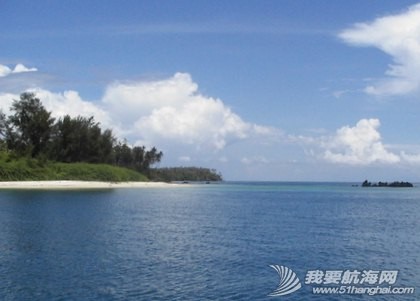
7. Sunset Bay. Also, beware of submerged rock Lat: 06.15.10'N Long: 99. 44.90'E
Latitude: 06.14.45'N Longitude: 99.42.98'E Average Depth: 7 to10 metres
Best months for anchoring: December to March Not so good: April to November
Description:
Sunset Bay - The name says it all - Magnificent sunsets, with a sundowner drink in hand on deck. It just doesn't get any better. This idyllic anchorage is a little bit off the beaten track for most yachts, who are busy coming or going from Kuah to Telaga or elsewhere and few tour boats come here. So most times you'll have it all to yourself. There's some nice snorkeling to be done on a coral reef at the above island in the NW corner of the anchorage, where there's also a clean sandy beach upon which to relax, or collect driftwood and shells. With no other boats zooming by, this is a good spot to clean your
waterline around the yacht before enjoying the next sunset. Ahhhh!!
NOTE:
No shops available. Fishing boats anchor there on occasions.
HOLDING:
Excellent holding in firm sand and mud.
DANGERS:
None - except that this is a lee shore in strong SW winds.
8. Pantai Cenang.
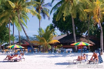
Latitude: 06.16.78'N Longitude: 99.42.66'E Average Depth: 2 to 4 metres
Best months for anchoring: December to March Not so good: April to November.
Description:
This anchorage is intended to cover the main beaches on the west coast - Pantai Cenang (pronounced Chenang) and Pantai Tengah. (Pantai means 'beach'). As this is the prime tourist area you can expect a lot more activity on the land and water, such as jet skis, para-sailing /water-skiing. Cenang needs anchoring at least 200 mtrs off shore. Tengah, (to the South) is deeper in close. Cenang has no protection from the south and can get quite rolly if the wind swings around from NE to SW during a late afternoon sea-breeze, which usually stops around sunset. The difference between high water mark
& low water mark during spring tides is over 100mtrs, so dinghies need to be hauled a long way up the beach if ashore forsome time.
NOTE:
There are many restaurants, pubs and attractions like Water World to visit. Some medium size supermarkets have basic needs.
HOLDING:
Firm sand. Longer than normal scope of chain suggested.
DANGERS:
None - except that this is a lee shore in strong SW winds.
9. Telaga Harbour
Latitude: 06.21.70'N Longitude: 99.40.51'E Average Depth: 2 to 4 metres
Best months for anchoring: December to April. Not so good: May to November.
Description:
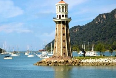
This photo was taken from inside Telaga Harbour Marina entrance channel, where you can see the artificial lighthouse. Two sandy islands with clean water and nice beach protect the anchorage from SW winds. It's a very popular spot for cruising yachts, so most times there are upwards of 20 vessels there. The nearby marina allows you to land your dinghy for RM5 p/day and enjoy the facilities of hot showers & toilets. For a further RM5 p/day WIFI connection is available for your laptop. (Not all spots work. Check with neighbour). Choice of cheap local and expensive western restaurants. For major
provisioning you need to hire a car or taxi to go to Matsirat or Kuah.
NOTE:
A few items are available at Petronas and small general store.
HOLDING:
Good holding in firm sand. Not much swinging room.
DANGERS:
None - except this is a lee shore in strongSW winds.
10. Datai Bay
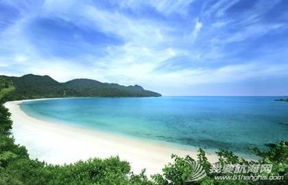
Latitude: 06.25.50'N Longitude: 99.40.30'E Average Depth: 2 to 5 metres.
Best months for anchoring: May to November. Not so good: December to April.
Description:
Datai Bay is the home of 2 of the most prestigious hotels in Langkawi ..the Datai and the Andaman. You can get a taste of their luxury by having a meal at one of the many restaurants or relax with a poolside drink. The area is otherwise very remote and you'd need to hire a car or taxi to get around to places like the Crocodile Farm or nearby waterfall and art museum. If you're a golf player, the beautiful Datai course will test your skills. The bay can become untenable if a strong NW wind picks up. If anchored there with a NE blowing, best to shelter behind the island at the mouth of the bay. Both of those winds are more likely to occur in Dec-April. Nice beach. Clear water.
NOTE:
There are no shops available in the immediate area.
HOLDING:
Excellent holding in firm sand and mud.
DANGERS:
None - except that this is a lee shore in strong NW winds.
11. Tanjun Rhu.
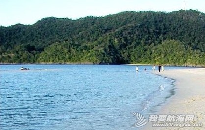
Latitude: 06.27.54'N Longitude: 99.49.30'E Average Depth: 2 to 3 metres.
Best months for anchoring: All year round Not so good: None.
Description:
Tanjung Rhu has 2 choices of anchorage. The outer area just after entering the bay from the northern channel is fairly restricted for where you can anchor, as a lot of it has shoals in the southern part. It can also get lumpy if winds freshen out of the West or NW. To enter the inner anchorage, keep to the North side of channel past the sand spit and drop the hook in the immediate basin area. Beware that the spit extends out into the channel at low tide, and depths inside vary. The inner area is protected from all winds. An interesting 3 mile ride in the dinghy is to take the SE arm which goes to "Hole In The Wall". The Tanjung Rhu Resort is worth a visit to see beautiful landscaping and enjoy a meal in luxurious surroundings. There's also a cheaper local restaurant on the sand spit, next to the tourist clothing stores
NOTE:
There are no shops for provisioning in this area.
HOLDING:
Good holding in firm sand/mud. Not much swinging room.
DANGERS:
Currents are extremely strong. Caution when swimming.
12. Hole In The Wall.
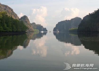
Latitude: 06.25.60'N Longitude: 99.52.11'E Average Depth: 2to10 metres.
Best months for anchoring: All year round Not so good: None.
Description:
The name..."The Hole In The Wall" clearly comes from the opening as seen above. Of all the anchorages, this one is totally "bullet proof " ...see for yourself.....there's not a ripple on the water. No matter what wind strength or direction, it's always calm in here. This photo is taken from where there's a branch in the river that goes to Rahmad's Floating Restaurant and Fish Farm. Long term rental of moorings for mainly absentee owners can be arranged with Rahmad. To go to Kuah, take 1nm dinghy ride to Kilim Jetty, then walk 300 metres to main road and flag down a taxi for a RM3 'share-fare' to Kuah town. Most mornings, several tour boats buzz by taking tourists to "eagle feeding". You might want to follow in your dinghy to see this activity.
NOTE:
There are no shops for provisioning in this area.
HOLDING:
Good holding in firm mud. Not much swinging room.
DANGERS:
Current can be strong at springs. Take care if swimming.
13. Pulau Timun.
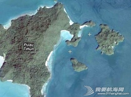
Latitude: 06.18.73'N Longitude: 99.56.76'E Average Depth: 5 to 10 metres.
Best months for anchoring: December to April Not so good: May to November.
Description:
Pulau Timun, (not to be confused with P.Tioman off the east coast of Malaysia), is a handy jumping-off spot if you happen to be heading 19 nm to Pulau Payar, or 60 nm to Penang. As it's the most easterly anchorage for Langkawi, it gives you a good head start. Being surrounded by a cluster of islands adds to the calm conditions in most winds, but being close to the open sea, sometimes there's a bit of ground swell to contend with. The water is clean & clear and there is some nice snorkeling to be found close to the shoreline. The satellite image above shows two choices of ideal anchorages.
NOTE:
There are no shops for provisioning in this location.
HOLDING:
Good holding in firm mud. Not much swinging room.
DANGERS:
No dangers, apart from obvious fringing reef.
14. Bumbon Island.
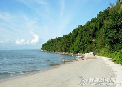
Latitude: 06.17.31'N Longitude: 99.52.10'E Average Depth: 3to 4 metres.
Best months for anchoring: May to Nov. Not so good: Dec to April
Description:
Pulau Bumbon is a popular choice of yachties who are perhaps going or coming to/from Kuah and wish to enter the RLYC or other locations with favourable tides & times on their side. Being less than 3 nm from Kuah makes it easy to work to ETA's and schedules. It's also a favourite spot for tour boats with a load of tourists to do a quick stop-off for snorkeling and swimming, but otherwise it's a quiet and peaceful place to enjoy. If you decide to stay a few days, there's a local restaurant in the opposite bay on the main Langkawi Island.
NOTE:
There are no shops for provisioning at this location.
HOLDING:
Good holding in firm mud. Swinging room is okay.
DANGERS:
No dangers, apart from obvious fringing reef.
注:以上资料是由马来西亚兰卡威YBC提供的。(网站: http://www.yachtbroker-charters.com)
|


